
Walks in the Fryers Ridge Forest
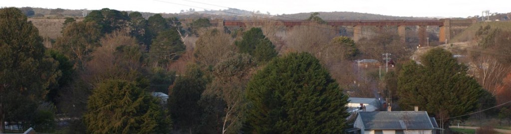
Taradale lies at the eastern border of one of the largest areas of forest in Central Victoria, the Fryers Ranges State Forest. This forest spans two undulating ridges running north-south, Fryers Ridge in the east and Porcupine Ridge in the west. The forest extends from the Coliban Main Channel in the east to the Castlemaine-Daylesford road in the west. The Pyrenees Highway between Elphinstone and Chewton forms the northern boundary and the Malmsbury-Daylesford Road is the southern boundary. The whole of the Fryers Ranges Forest is covered by the Vicmap MALMSBURY map ( number 7723-N 1:50 000 map series) To view a map of the Fryers Ridge Nature Conservation Reserve click here (click on map for full page version): Fryers Ridge map The walks/rides described on this page are a small selection of possible excursions using the tracks shown in this map Note: all tracks in this forest are managed by the Department of Environment, Land, Water & Planning (DELWP). They are vehicular tracks designed for use by emergency vehicles and can be walked and ridden in almost all conditions. The forest stands on the ancient gold-bearing Ordovician slate rocks. See Geology for more information. Poor soil and past activities have resulted in the forest that we see today. See History The forest is home to one of the richest assemblages of wild flowers in Central Victoria. See Wildflowers. The wildflower season commences in June/July and continues to the end of the year. Walks from the end of Fryerstown Road – Walks from Cypress Drive – Walks from Dearden Creek Track
Walks from the end of Fryerstown Road
 Parking spot: enter the forest and immediately turn left onto Salt Water Track. A turning circle around a handsome young yellow box tree provides parking for several vehicles.
Rilens circuit (1 hour)
Starting at the Main Channel, the route follows the Old Coach Road, first up a steep hill then levelling out. After about 1.5 km look for the start of Webbs Track on the left and follow this track for a few hundred metres to meet Rilens Track on the left. Follow Rilens Track to its end, where it meets Salt Water Track. Turn left and follow this track to starting point.
No Name circuit ( 1 hour)
At the Main Channel turn right into Salt Water Track. The track rises then drops steeply to cross north Kangaroo Creek. Turn left onto No Name Track* and follow this track, climbing gently then more steeply until it meets Conns Track. Turn left and follow Conns Track until it meets the Old Coach Road. Turn left and return to starting point on this road.
*in the 1990s the Department of Environment etc (then DNRE) installed name posts for all forest tracks, taking advice from local woodsman Bob Maltby who knew the tracks according to which wood collector had had rights to cut wood in that area of forest in earlier days. The story goes that Bob had no name for this track, hence its name.
Conns circuit ( 2+ hours)
Starting at the Main Channel, the route follows the Old Coach Road, first up a steep hill then levelling out. Look for Conns Track on the right. This track takes the traveller as far as the main ridge of the forest, crossing north Kangaroo Creek then climbing in a series of steep sections with gentle slopes in between. (The top section forms the top boundary of a DELWP controlled burn in the autumn of 2018.) At the end of Conns Track turn left into the Fryers Ridge road. This road runs south along the length of the main ridge of the forest, eventually exiting onto the Doxa Road (turn left for the Malmsbury-Daylesford Road)
A few hundred metres south along Fryers Ridge Road there is a road on the left. This is the top of the Old Coach Road. On the right the Ridge Road passes through a cutting which is a noted hotspot for wildflowers. Definitely worth a visit. There are several options for the return journey:
- Return via Old Coach Road (2 hours)
- Continue through the cutting. The Old Coach Road continues down to Fryerstown on the right. Keep left, staying on the Ridge road for about 3 km. Views of Mt Macedon (left) and Mt Tarrengower in places through trees. At the bottom of a long descent in sweeping curves, turn left onto Antonios Track. After 100 metres or so, turn left onto Bradleys Track. Follow this track steeply uphill then steadily down all the way to the Old Coach Road, where a right turn takes the traveller back to the end of Fryestown Road (2.5-3 hours)
- As for option 2 but instead of taking Antonios Track off the Ridge Road, keep on this road for another few kilometres to the head of Dearden Creek Track. Turn left into this track and descend steadily for about 3 km, past the south end of Antonios Track and a private entrance until a cross road is reached. Turn left into Salt Water Track and follow this track for about 4 km to the end of Fryerstown Road (4 – 4.5 hours)
Walks from Cypress Drive
Parking spot: drive along Cypress Drive to where it crosses the Coliban Main Channel and enters the forest. Continue for about 100 metres to the start of Salt Water Track. At this point there is a place to park one or two cars.
Salt Water Circuit (one hour)
Walk south along Salt Water Track for about 2.5 km until the start of No Name Track. At this point turn sharp left into the start of a section of the Main Channel Track. Follow the Channel Track for about 2.5 km to where it meets Cypress Drive. Exit onto Cypress Drive turn left and return to car. This is a relatively gentle walk with some minor uphill and downhill sections on Salt Water Track while the Channel Track is almost completely flat.
Timmins Track (2 hours)
From the parking spot walk north for about a kilometre along Cypress Drive/Salt Water Track towards Elphinstone (both names are used for this forest section of the road between Taradale and Elphinstone). Pass the start of Bones Gully track and continue on to the start of Timmins Track, at the edge of cleared land. Turn into Timmins Track and follow it for about 3 km to the main ridge. There is one very steep section. Near the top the track forks. Either fork leads to the main ridge. In wildflower season it’s worth taking the right hand fork as the top track (Tunnel Hill Track) is rich in flowering plants. Turn left (south) and follow Tunnel Hill Track to Fryers Ridge Track. Continue around a sharp left hand bend to the top end of Conns Track. Turn into Conns Track and descend as far as the top of Bones Gully Track. Here there are two options:
- Turn into Bones Gully and descend steadily to Cypress Drive. (1.5 to 2 hours) Turn right and return to car. Note: The lower section of the creek in Bones Gully contains several ingenious constructions designed to prevent further eroding of the gully, built by the land manager of the time (DNRE/DSE). Most of these were successful until the La Nina event of 2011/2012 when all but one were overwhelmed by flood waters, with catastrophic erosion around the structures. Worth a look.
- Continue along Conns Track to No Name Track (2 to 2.5 hours). Turn down No Name Track continuing to the end, where it joins Salt Water Track. There are two options for returning to your starting point: either turn left into Salt Water Track and continue to the end where the parking spot is located, or go straight ahead to the Main Channel Track. Follow this track to the junction with Cypress Drive. Turn left and return to the parking spot.
Walks from Dearden Creek Track
parking spot: from Old Drummond Road, follow Dearden Creek Track to the Coliban Main Channel. Soon after the Channel Kemps Track is on the left hand side. A small turning circle around a tree to the right of the track provides parking for 2 or 3 cars.
Telecom Track circuit (1.5 hours)
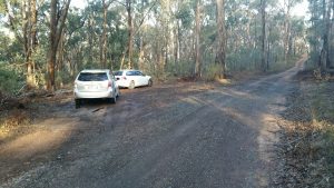
From the parking spot follow Kemps Track. The track climbs then drops down fairly steeply to cross Kangaroo Creek, after which it climbs back up to high ground. After almost 2 km the track crosses the Telecom Track. This track is narrower, rougher and less distinct than Kemps. (photo here)
Turn right onto Telecom Track, dropping down to cross the southern arm of Kangaroo Creek then climbing to more even ground. Meet the Lower Kangaroo Track (no sign) which is a larger track and turn right. Follow this track back to Dearden Creek Track, then turn right and return to the parking spot. Note: in very wet weather the creek crossings on Lower Kangaroo Creek Track and Telecom Track may be difficult to navigate.