
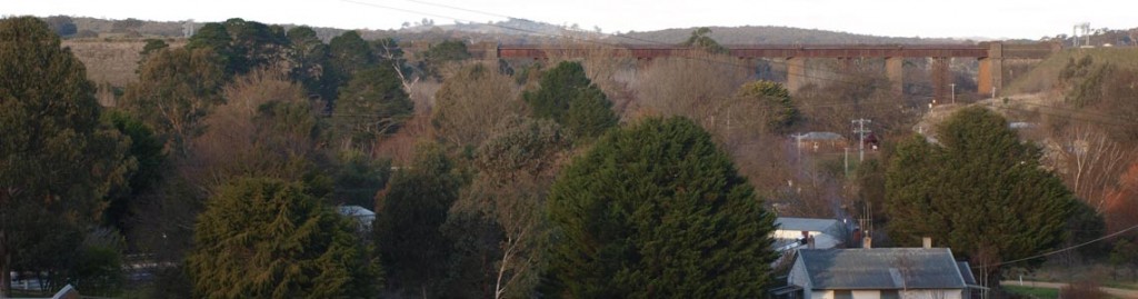
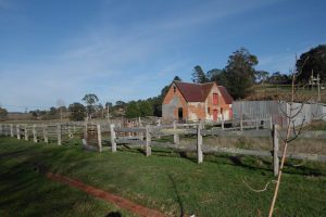
District Walks
to view map click here: Taradale district walks map
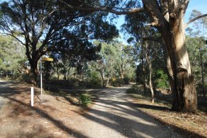
Starting from the Mineral Springs Reserve there are six routes along local roads that lead to the Coliban Main Channel.
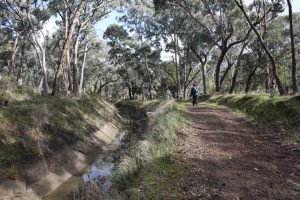
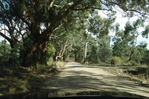
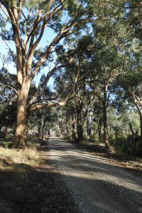
The Coliban Main Channel runs along the edge of the Fryers Ridge forest to the west of town. Walkers and cyclists can use these routes plus a section of the Channel track as a pleasant circuit walk or ride through varied countryside.
Starting from the Mineral Springs Reserve there are six routes along local roads that lead to the Coliban Main Channel.
The Coliban Main Channel runs along the edge of the Fryers Ridge forest to the west of town. Walkers and cyclists can use these routes plus a section of the Channel track as a pleasant circuit walk or ride through varied countryside.
TRACKS TO/FROM THE COLIBAN MAIN CHANNEL
Track 3 Tyquins Road (4.5 km)
Leave the Mineral Springs park via the playground. Turn left into High St. Follow this road uphill past school and south out of town. After walking 1.5 km in open country turn right into Martins Road.This flat road is straight until it turns sharp left. It then continues until it joins Conlans Road coming in on the left. Bear right into Conlans Road and descend steeply into Back Creek valley and Liberty Flat, site of the first gold diggings in Taradale.
After crossing the creek, turn left into Tyquins Road. Travel 1.5 km along the Back Creek valley side to Tyquins Cottage built ca 1865 and a fingerpost sign ‘Channel Track’. Follow this track uphill to the start of the open Channel. This is the mouth of the syphon that carries the water across the Back Creek valley.
For more information on this remarkable structure, see Coliban Water history
Track 4 Old Drummond Road (4 km)
Leave the Mineral Springs park via the playground, cross High Street, pass a historical sign board and follow the laneway for 100 metres to meet Old Drummond Road. Turn left and follow this road along the Back Creek flats.
After about a kilometre the road climbs a low hill. Soon after this the road becomes tree-lined. The surface changes to gravel and soon after drops downhill to meet Conlans Road at a T intersection.
This point is about half way. Bear right up a short steep hill. At the top of the hill Pass Deardens Creek track on the right. The road now drops down into open country. For the last half kilometre the road is tree-lined, eventually crossing the deep gully of Kangaroo Creek. A short distance later the road crosses the Coliban Main Channel at the entrance to the forest.
Track 4A Deardens Creek (3.2 km)
The first 2.5 kilometres is the same as for Track 4 (Old Drummond Road). After turning right turn at Conlans Road and going up a short hill, turn right into Deardens Creek Track. Follow this track for about half a kilometre to the Coliban Main Channel
To complete a circuit of about 9 km, turn right and enter the Channel track, following this section for about 4 km to meet Fryerstown Road. Follow Track 5 back to town.
For a shorter circuit walk of about 4.5 km, drive to the end of Dearden Creek Track. There is a parking spot on the left inside the forest, next to the start of Kemps track. Enter the Channel track heading south and follow the track to the end of Track 4. Walk north along Old Drummond Road to the start of Dearden Creek Track, turn into this track and return to the parking spot.
Track 5 Fryerstown Road (1.8 km)
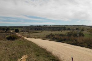
Leave the Mineral Springs park via the playground. Turn right into High Street and walk to the bottom of the hill. Two roads start on the left at this point: Old Drummond Road and Roderick Street. Turn into Roderick Street and go up a long tree-lined hill. The road levels and meets Davy Street after 800 metres. Bear left into the start of Fryerstown Road in open country. After another 700 metres, pass Sargeants Road on the left, admiring a large yellow box tree on the roadside.
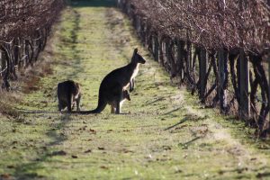
The last section of the route passes the Fryerstown Road vineyard before reaching the Coliban Main Channel at the forest entrance.
Track 5 Fryerstown Road (1.8 km)
Leave the Mineral Springs park via the playground. Turn right into High Street and walk to the bottom of the hill. Two roads start on the left at this point: Old Drummond Road and Roderick Street. Turn into Roderick Street and go up a long tree-lined hill. The road levels and meets Davy Street after 800 metres. Bear left into the start of Fryerstown Road in open country. After another 700 metres, pass Sargeants Road on the left, admiring a large yellow box tree on the roadside.
The last section of the route passes the Fryerstown Road vineyard before reaching the Coliban Main Channel at the forest entrance.
Track 6. Cypress Drive (1.9 km)
Leave the Mineral Springs park via the playground. Turn right into High Street. After the first hill section turn left into Arthur Street then, after a few metres, right into Pemberton Hill Road. This small road with its brick bridge is a short section of the original main road. After the bridge, reach a large parking area. Turn left into Cypress Drive. Follow the road along a valley to a T intersection. Turn right and go up the hill. Soon after the road levels out, scenic Tara Lake appears on the right. This large man-made lake was constructed in 1975 by Reg Broad.After the road veers away from the lake view, it crosses the Coliban Main Channel. This is the end of Track 6.
To complete a circuit route of about 7 kilometres. cross the stile on the left and enter the Coliban Main Channel Track. Follow this track beside the Channel until a gate is reached. Exit onto a forest track, turn left and follow signs up a short steep hill, then gently downhill to the end of Track 5 (Fryerstown Road). Follow this track back to the Mineral Springs park. This is a popular walk with the locals.
For a longer circuit of about 9 kilometres, cross the stile on the right and enter the Coliban Main Channel. Follow this track beside the Channel until a stile is reached. Cross over to join the end of Track 7. This section of Channel, a noted hotspot for woodland birds, is popular with bird watchers.
Track 7. Cemetery and Wright Street (3.4 km)
Leave the Mineral Springs park via the north exit (near toilets). Turn right and follow Roderick Street to a T intersection. Turn left into Lyell St, passing the recreation reserve. Walk steadily uphill road, noting that the road becomes Potts Road.
Pass Pennos Road on the left. Opposite is Station Street leading to the Taradale station (now closed) on the busy Melbourne-Bendigo line. A short detour is recommended for viewing the old station and goods shed. After about a kilometre reach the level crossing and turn left into Back Road. Follow this road for a kilometre to its junction with Calder Highway. Turn right. After another 400 metres the Taradale Cemetery is on right, noted for its wildflowers in spring. Continue along the Calder Highway to Wright Street on the left. About 300 metres further the entrance to the Coliban Main Channel is on the left of the road.
Sargeants Road Circuit ( 2.6 km)
This circuit follows the first section of Track 4 (Old Drummond Road) then turns off right along the delightfully scenic Sargeants Road to meet Fryerstown Road (Track 5) which brings the traveller back to town.
Leave the Mineral Springs park via the playground, cross the highway, pass a historical sign board and follow the laneway for 100 metres to meet Old Drummond Road. Turn left and follow this road along Back Creek flats. After one kilometre ascend a low hill. Turn right into Sargeants Road (gravel surface). Follow this tree-lined road up a steady hill then down a short incline to meet Fryerstown Road. Turn right. At the road junction take either fork, Davy or Roderick Streets (Davy Street is a sealed road, Roderick Street passes historical buildings). Turn right at the highway and return to the Mineral Springs park.
Conlans Road Circuit (6.3 km).
This circuit follows Old Drummond Road (Track 4) as far as the intersection with Conlans Road, then turns left leaving Track 4 and continues on Conlans Road then via highway back to town.
Leave the Mineral Springs park via the playground, cross High Street, pass a historical sign board and follow the laneway for 100 metres to meet Old Drummond Road. Turn left and follow this road along the Back Creek flats. After about a kilometre the road climbs a low hill. Soon after this the road becomes tree-lined. The surface changes to gravel and soon after drops downhill to meet Conlans Road at a T intersection. Turn left and continue along Conlans Road, past the end of Tyquins Road, across Back Creek, up a steep hill and straight ahead into Martins Road. Follow Martins Road to the old highway, turn left and return to town.