
Taradale by Track & Trail
Town Walks
to view map click on link below
Taradale town walks map
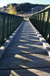
Track 1. King Billy Bridge circuit (2km)
Exit the Mineral Springs via the north, with the toilet block on your right. Walk north up Murchison St (church on right), turn left into Davy Street at intersection.After a short distance turn right into Wickhams Street and go uphill. Wickhams Street becomes a walking track which drops down to a creek. Cross the creek via King Billy Bridge onto Hood’s Track. At the end of Hoods Track turn right into Pennos Rd and continue to a sealed road. Turn right at this intersection. Go down the hill, turn right into Roderick Street and return to Mineral Springs
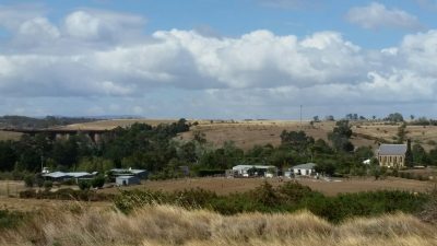
(Note: for a view over town and surrounds turn left at the end of Hoods Track and climb the steep hill to the end of Pennos Road, then retrace steps.)
Track 1. King Billy Bridge circuit (2km)
Exit the Mineral Springs via the north, with the toilet block on your right. Walk north up Murchison St (church on right), turn left into Davy Street at intersection.After a short distance turn right into Wickhams Street and go uphill. Wickhams Street becomes a walking track which drops down to a creek. Cross the creek via King Billy Bridge onto Hood’s Track. At the end of Hoods Track turn right into Pennos Rd and continue to a sealed road. Turn right at this intersection. Go down the hill, turn right into Roderick Street and return to Mineral Springs
(Note: for a view over town and surrounds turn left at the end of Hoods Track and climb the steep hill to the end of Pennos Road, then retrace steps.)
Track 2. Viaduct Track (2 km)
 Cross the creek via the green bridge in the Mineral Springs park. Turn left onto the track which runs beside Back Creek.
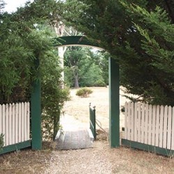
Follow this track to Lyell Street, cross the road and pass through an arched gateway. The track continues beside the creek. Enter the wooded ‘fairy dell’ area where there is a picnic table. At the end of the wood the track exits onto a road.
Turn left.
Go past a cottage to join the‘Royal Oaks Walk’ which leads under viaduct to the site of the Royal Oaks (sadly lost to storms) and the entrance to Barkly Park. Return via same route.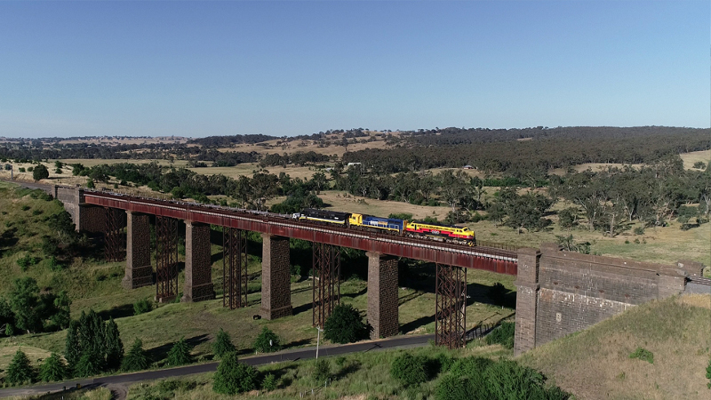
Track 2. Viaduct Track (2 km)
Cross the creek via the green bridge in the Mineral Springs park. Turn left onto the track which runs beside Back Creek.
Follow this track to Lyell Street, cross the road and pass through an arched gateway. The track continues beside the creek. Enter the wooded ‘fairy dell’ area where there is a picnic table. At the end of the wood the track exits onto a road.
Turn left.
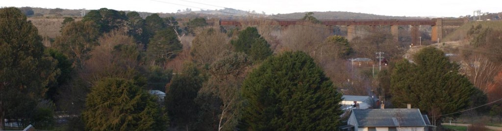
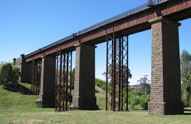
The viaduct now comes into view.
Go past a cottage to join the‘Royal Oaks Walk’ which leads under viaduct to the site of the Royal Oaks (sadly lost to storms) and the entrance to Barkly Park. Return via same route.
Tour of Taradale History
The Taradale Historical Group have published a map and notes showing all the significant historical sites in the township of Taradale. Walkers can follow the trail of 12 signboards around the town outlining the history of some significant sites from the gold rush onwards.